“Learning by Doing” - John Deway
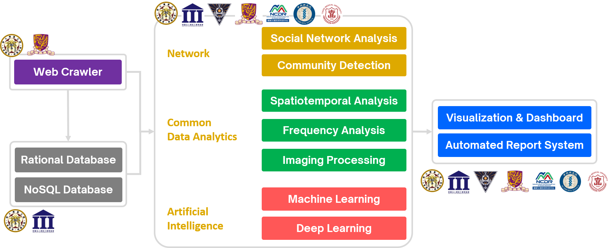
Across academic, governmental, and industrial fields ...
-
Assistant Professor @ Department of Geography, National Taiwan Normal University
Aug. 2025 - Present
- Develop diverse spatial statistical algorithms to analyze complex urban geographic processes and generate insightful findings to support policy planning and decision-making.
- Integrate explainable artificial intelligence (XAI) to interpret machine learning model predictions, with broad applications in language center operations planning, cybersecurity risk prediction, landslide susceptibility mapping, spatiotemporal distribution of plant diseases and pests, and gravitational wave signal detection.
- Develop intelligent medical algorithms integrated with machine learning models to detect and classify arterial blood pressure waveform variations during CPR in OHCA patients, enabling assessment of chest compression positioning accuracy.
- Teaching history: GeoAI, Applied Machine Learning, Python Programming, Social Network Analysis, Web Crawler Practice, Geographic Information System and Medical Geography.
-
Projected Assistant Professor @ Department of Geography, National Taiwan Normal University
Aug. 2023 - Jul. 2025
-
Leveraged graph neural network and graph machine learning to train urban and rural human mobility prediction model for future urban planning and human flow prediction.
- Teaching history: Social Network Analysis, Web Crawler Practice, Urban GIS and Medical Geography.
-
Assistant Professor @ Master Program in Intelligent Computing and Big Data, Chung Yuan Christian University
Assistant Professor @ Undergraduate Program in Intelligent Computing and Big Data, Chung Yuan Christian University
Aug. 2022 - Jul. 2023
-
Leveraged GeoAI to characterize urban and international human mobility for building a simulated mobility network.
- Teaching history: Probability & Statistics (1), Big Data Fundamentals and Application, Capstone Project (II), Introduction to Natural Science and Artificial Intelligence, and Intro. to EECS Profession.
-
AI Consultant @ Taiwan CyberSecurity Foundry Company
Apr. 2022 - Apr. 2023
- Conducted machine learning techniques to classify cybersecurity alerts, and its accuracy reached 99.7%.
- Combined federated learning framework to construct serverless edge detectors for network traffic data.
-
Postdoctoral Researcher @ Dept. of Radiology, School of Medicine, Taipei Medical University
Postdoctoral Researcher @ Dept. of Radiology, Taipei Municipal Wanfang Hospital, Taipei Medical University
Aug. 2021 - Jul. 2022
-
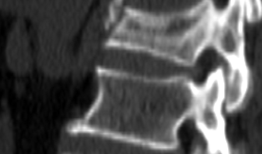
Evaluated the 3D trabecular microstructure parameters to reveal the relationship between areal BMD dual-energy X-ray Absorptiometry and volumetric BMD from QCT.
-
Investigated the vertebral fracture assessment problems with a 2D plain-film radiograph and different 3D CT grading methods (conventional, consensus, and global search).
-
Developed a 100% accuracy and rapid automated bone mineral density (BMD) report generator to improve efficiency for report production.
-
Data Scientist | A Joint Business Planning on Social Media Marketing @ School of Journalism and Communication, The Chinese University of Hong Kong
Aug. 2019 - Present
-
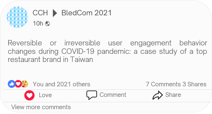
Collected fine-dining brand’s Facebook engagement data to demystify the pandemic impact on social media behavior from 2019 to 2021.
-
Applied ML techniques and time-series analysis in social media data to predict the reservation trend.
-

Data Scientist @ Institute of Sociology, Academia Sinica
Mar. 2019 - Jul. 2023
-
Utilized complex network analysis techniques to investigate the social network formulation through quantitative and qualitative approaches.
-
Conducted spatiotemporal statistical analyses (SaTScan & LISA) to reveal the preferred locations of multi-religious landscapes with 400-year cultivation data in Taipei city.
- Applied Louvain community detection and ML techniques (PCA and hierarchical clustering) to demystify the association between pilgrimage network and religious development history.
-
Research Assistant & Teaching Assistant @ Geospatial Computational Science Laboratory, Dept. of Geography, NTU
Aug. 2019 - Jul. 2021
-
Timely estimated the global exposure risk mobile app for direct and transfer air passengers to meet WHO healthcare goals and traveler needs in the COVID-19 pandemic.
-
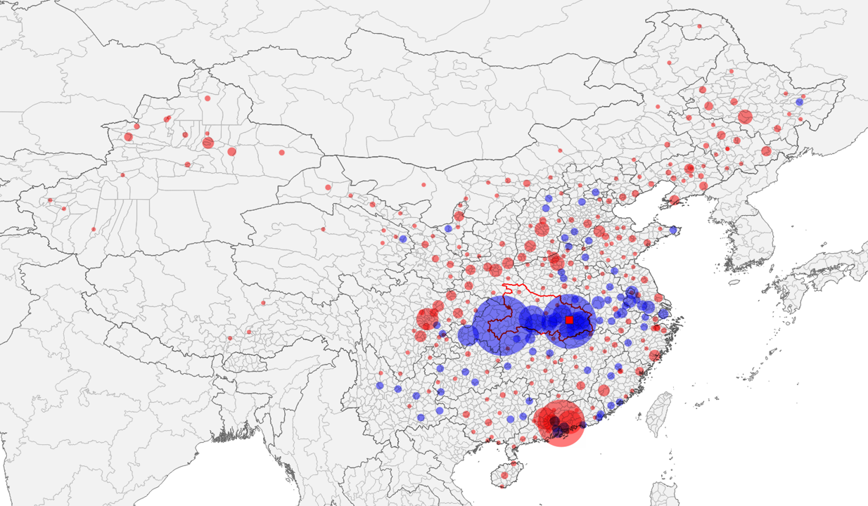
Demystified the role of transfer activities in cross-province transmission after Wuhan city lockdown by web crawling 1+ million railway schedule data during the COVID-19 pandemic.
- Utilized survival analysis and community detection for H1N1 global disease transmission with 85+ million global flight schedules.
-
Research Assistant & Teaching Assistant @ Remote Sensing and Spatial Knowledge Laboratory, Dept. of Geography, NTU
Mar. 2013 - Jul. 2021
-
Designed an automated low-frequency electromagnetic signal processing and pattern recognition system.
-
Applied ML techniques in seismic precursor analysis and automated vertical stratum structure recognition.
-
Data Scientist Engineer @ CyberSecurity Technology Institute, Institute for Information Industry (III)
Aug. 2017 - Feb. 2019
- Processed air pollution data to identify the spatiotemporal causal relationship between stationary emission sources and ambient air quality
-
Developed a real-time and open-source cybersecurity monitoring system with Elasticsearch, Logstash, and Kibana (ELK), which analyzed the suspicious packets.
-
Implemented a generative adversarial network (GAN) model to detect malicious behaviors with a 250 GB malware dataset.
-
Research Assistant & Teaching Assistant @ Debris-flow Disaster Prevention Laboratory, Dept. of Social and Regional Development, NTUE
May 2013 - Jan. 2016
-
Leveraged social media advertising to promote crowd-sourcing debris-flow disaster platform and mobile app.
-
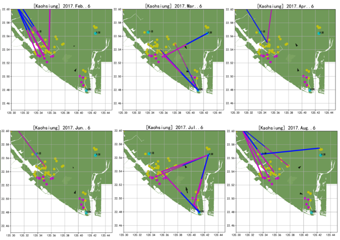
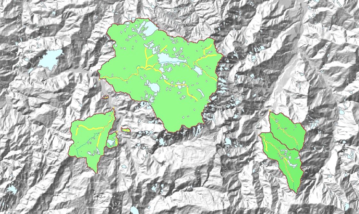
Adopted several spatiotemporal hydrological analyses to timely characterize debris-flow disasters to informed experts and public users on a website and mobile app.
-
Internship @ Slopeland Division | National Science and Technology Center for Disaster Reduction (NCDR)
Jul. 2011 - Aug. 2011
-
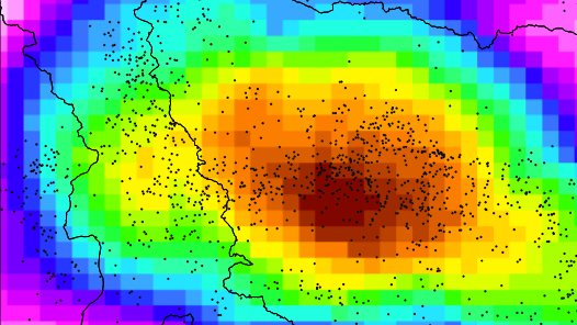
Conducted spatial statistical methods to reveal the hidden debris flow and landslide areas from massive high-resolution remote-sensing images.